Forge a path to a high-demand career
Looking for a high-paying, fast-growing career? A degree in geospatial science from the Arthur Temple College of Forestry and Agriculture will provide you with a combination of technical expertise, problem-solving skills and hands-on experience that will give you a competitive edge in the job market. According to the Bureau of Labor Statistics, job growth for spatial science-related occupations is 19%, which is much higher than the national average. That includes careers for cartographers, photogrammetrists and other spatial science paths.
Welcome to geospatial science!
If you’re like most prospective students and parents, you probably have a few questions about who we are and what we do. You might even be wondering what “geospatial science” means.
We would like to take this opportunity to answer some common questions and clear up some common misconceptions about our program:
- Although the name “spatial” sounds like “space,” this is not an engineering program. Geospatial science is an applied science program that draws from a variety of other disciplines, such as cartography, surveying, hydrography, forestry, environmental science and even sociology and anthropology.
- Graduates of the geospatial science program are prepared for careers in a wide variety of industries, including land surveying, oil and gas, historic preservation, environmental consulting, archaeology and resource conservation.
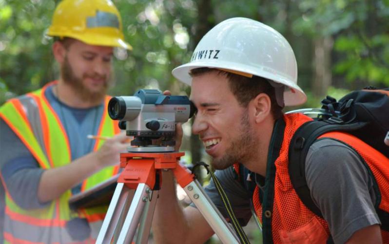
- Geospatial science is a technology-focused program. Students studying geospatial science learn to use a variety of state-of-the-art hardware and software, including geographic information systems, drones, surveying equipment and global positioning systems.
We encourage you to explore everything our program has to offer and learn more about degree programs and potential career paths.
A message from Dr. Matthew McBroom, associate dean of the College of Forestry and Agriculture
Careers in geospatial science are among the fastest-growing in the world today. Successful professionals in this dynamic field must not only have the scientific and technical expertise demanded by this STEM profession, but they also need applied, hands-on experience as well. From piloting unmanned aerial systems to interpreting the latest satellite imagery, geospatial science students at SFA are engaged starting in their freshman year and learn by doing.
With 100% employment rates, the success of graduates from the spatial science program speaks for itself. This makes a Bachelor of Science in geospatial science from SFA an excellent investment for the future.
Matthew McBroom, Ph.D.
936.468.2313
mcbroommatth@sfasu.edu